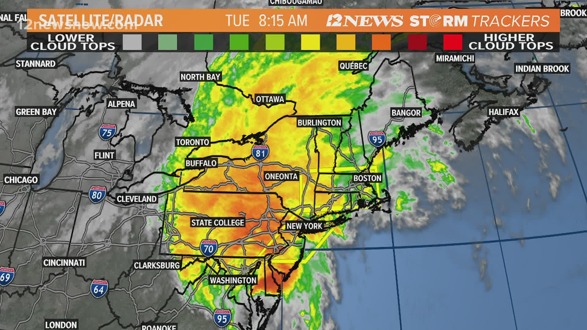
BEAUMONT, Texas — While Isaias weakened into a topical storm Tuesday morning, it is still bringing strong winds, heavy rain and a tornado threat to parts of the east coast.
A tornado watch has been issued for several major metropolitan areas, including New York City and Philadelphia, as Tropical Storm Isaias travels up the East Coast.
At Noon EDT Tuesday, Tropical Storm Isaias was located 10 miles west-southwest of Wilmington DE, or 35 mi west-southwest of Philadelphia with maximum sustained winds of 70 mph.
Isaias was moving to the north-northeast at 35 mph. Wind gusts of 40-60 mph are moving into the New York City area Tuesday afternoon.
Isaias made landfall as a Category 1 hurricane around 11:10 p.m. EDT Monday near Ocean Isle Beach, North Carolina, as an 85-mph storm, according to the National Hurricane Center.

Forecasters said a weather station at Oak Island, North Carolina, reported sustained winds of Category 1 hurricane strength at 76 mph, with a gust to 87 mph. Reports from the coastline included impacts from heavy rain, high winds and big surf.
Isaias is forecast to continue up the East Coast into the mid-Atlantic states Tuesday and the northeastern states Tuesday night. Tropical storm warnings continue all the way up into Maine.


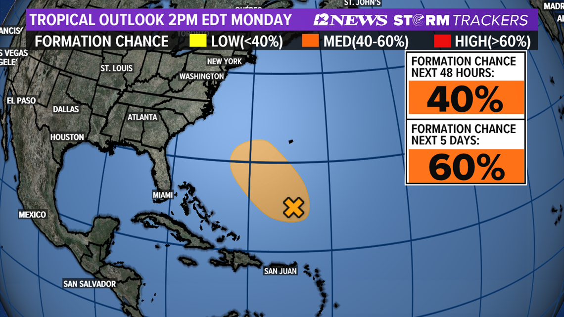
INVEST 94L
Invest 94L is located about 470 miles to the south of Bermuda and is producing disorganized showers and thunderstorms. A depression may form over the next couple of days as it moves northwest.
The storm poses no threat to the Gulf of Mexico presently.

2020 HURRICANE SEASON
This is the first hurricane season in recorded history that nine tropical storms have formed before Aug. 1. Isaias is also the earliest "I" storm ever recorded, breaking the old record set by Hurricane Irene, which first became Tropical Storm Irene on Aug. 7, 2005.
The Atlantic Hurricane season began on June 1, and it was an early start to what is forecast to be a busy year for the tropics.
T.S. Arthur and T.S. Berta both formed before hurricane season officially began, making 2020 the sixth hurricane season in a row with at least one named storm before June 1.
T.S. Cristobal became the earliest third name storm on record in the Atlantic Basin when it formed in the Gulf of Mexico on June 1.
NOAA has forecast an above-average hurricane season with 13 to 19 named storms (winds of 39 mph or higher), of which 6-10 could become hurricanes (74 mph or higher).
NOAA forecasts that there could be between three to six major hurricanes (Storms that reach category 3 or above).
RELATED: The US has already endured 10 weather disasters that exceeded $1 billion in damage this year