

BEAUMONT, Texas — The 12News StormTrackers are closely watching the progress of Hurricane Delta as it moves inland Friday evening.
Hurricane Delta's winds have slowed to 75 mph making it a barely category one storm about four hours after it officially made landfall in Creole, Louisiana according to the National Hurricane Center.
Once wind speeds drop below 74 mph Delta will be a tropical storm.

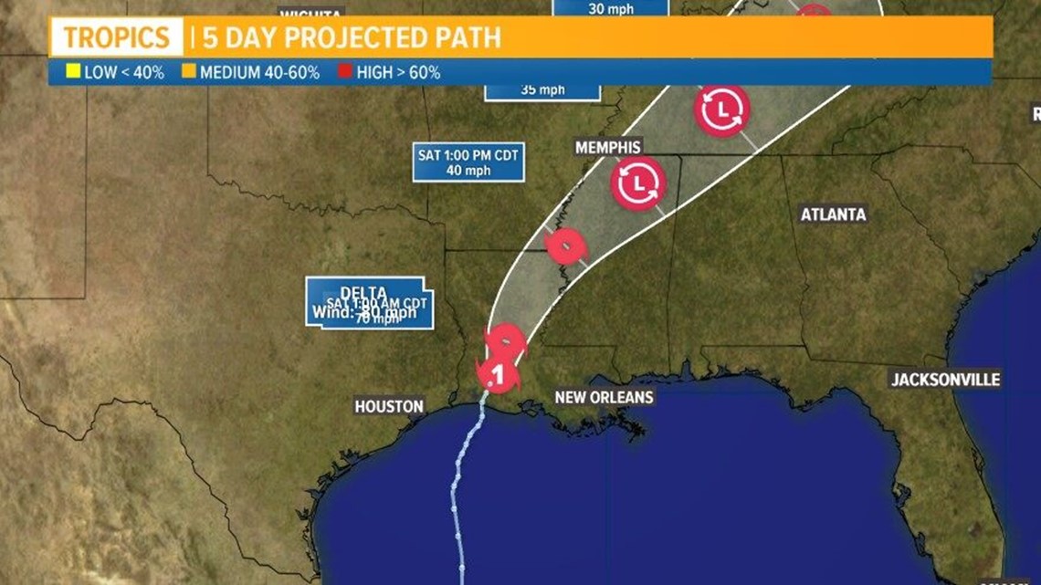
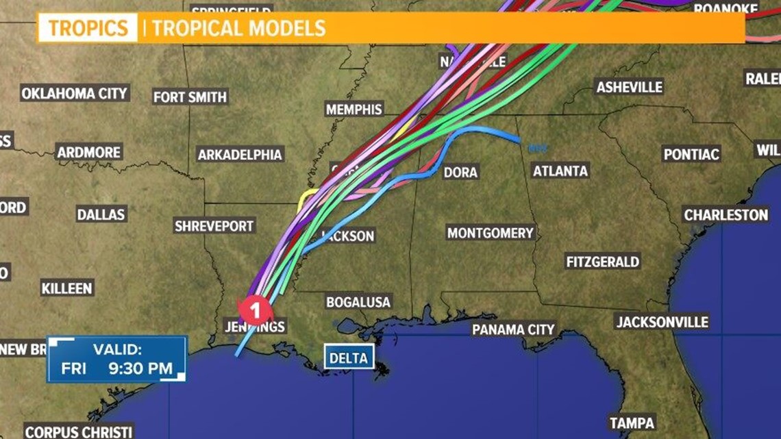
The storm is moving inland headed north-northeast at 15 mph and is expected to continue this track through Saturday morning according to the National Hurricane Center's 10 p.m. update.
The Storm Surge Warning from High Island, Texas to Sabine Pass and a Tropical Storm Warning west of San Luis Pass, Texas have both been discontinued.
The Southeast Texas coast remains under a hurricane warning extending from High Island to Morgan City, La, as Hurricane Delta moves inland.
TIMING
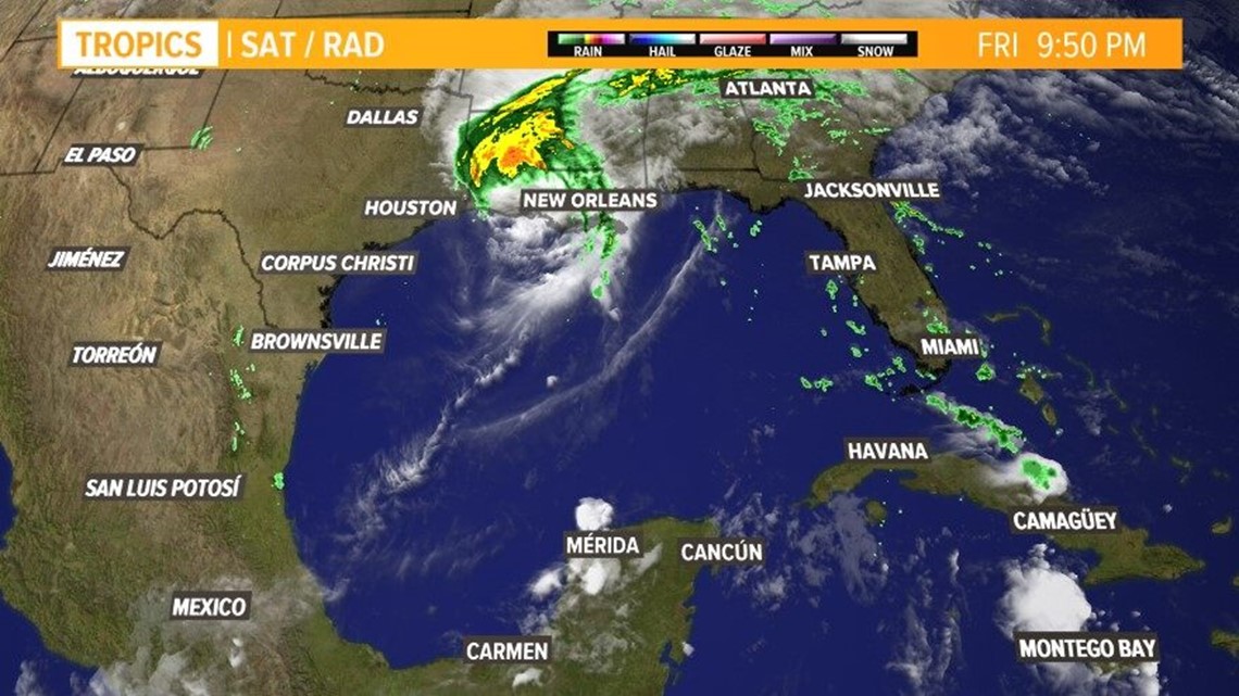
Delta officially made landfall in Creole, Louisiana, around 6 p.m. according to the NHC. The storm started moving ashore around 5 p.m. Friday.
It's expected to continue northward over land, and Chief Meteorologist Patrick Vaughn believes Southeast Texas will be done with Delta by late Friday night.
STRENGTH
Hurricane Delta is a category one storm with maximum sustained winds of 75 mph.
Hurricane-force winds extend outward up to 35 miles from the center and tropical-storm-force winds extend outward up to 160 miles.
Continued weakening is forecast, and Delta should become a tropical storm, and then a tropical depression, on Saturday.
TRACK
At 10 p.m. Friday, Delta was moving north-northeast at 14 mph as it moves over Louisiana.
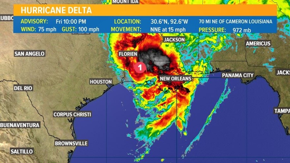
The storm continues to move inland and is currently about 70 miles Northeast of Cameron, La.
The center of Delta should move across central and northeastern Louisiana tonight and Saturday morning. After that time, the system is forecast to move across northern Mississippi into the Tennessee Valley.
Hurricane Delta Track & Models


WATCHES & WARNINGS
A Storm Surge Warning is in effect for Cameron to the Mouth of the Pearl River, Louisiana including Vermilion Bay and Lake Borgne
A Hurricane Warning is in effect for High Island to Morgan City, Louisiana.
A Tropical Storm Warning is in effect for west of High Island to Sargent, east of Morgan City, Louisiana to the mouth of the Pearl River, including New Orleans, Lake Pontchartrain and Lake Maurepas.
A Tropical Storm Watch is in effect for east of the mouth of the Pearl River to Bay St. Louis Mississippi.
Tracking Hurricane Delta
Update from the National Hurricane Center:
At 1000 PM CDT (0300 UTC), the center of Hurricane Delta was located near latitude 30.6 North, longitude 92.6 West.
Delta is moving toward the north-northeast near 15 mph (24 km/h), and this motion is expected to continue through Saturday morning.
A motion toward the northeast is then expected through Sunday night. On the forecast track, the center of Delta should move across central and northeastern Louisiana tonight and Saturday morning.
After that time, the system is forecast to move across northern Mississippi and into the Tennessee Valley.
Maximum sustained winds have decreased near 75 mph (120 km/h) with higher gusts.
Continued weakening is forecast, and Delta should become a tropical storm, and then a tropical depression, on Saturday.
Hurricane-force winds extend outward up to 35 miles (55 km) from the center and tropical-storm-force winds extend outward up to 160 miles (260 km).
The estimated minimum central pressure is 972 mb (28.71 inches).
Be prepared if a storm comes our way
BEFORE THE STORM
- Make a home inventory
- Have a current copy of your declarations page that has your policy number and your agent's number
- Review your policy with your insurance agent to determine if you have adequate coverage
- Repair loose boards, shingles, shutters and downspouts to prevent them from becoming an issue in high winds or torrential rain
- Have an evacuation plan, and include plans for your pets
- Make sure your emergency equipment is in working order, including a battery-powered radio, flashlights and extra batteries. Also, make sure to gather all medicine, replenish your first-aid kit and stock a week's worth of non-perishable food and water
- Charge your cell phone and fill your car with gas
- Program all emergency phone numbers
DURING THE STORM
- If you are advised to evacuate, leave as soon as possible. Retain all related receipts - they may be considered in your claim. If you aren't in a recommended evacuation and you plant to stay home, stay informed by listening to weather alerts
- Keep windows and doors closed at all time, and, if possible, board them up with wooden or metal shutters
- Stay away from the windows and in the center of the room, or, stay in an interior room
- Avoid flood water, as it may be electrically charged from downed power lines
- Check on family members and friends
AFTER THE STORM
- Check to be sure your family members are safe
- If you did evacuate, wait for official notice that it is safe to re-enter your neighborhood and your house
- Document damaged property, and take photos and videos. Don't dispose of any damaged items without approval
- Keep a record of any temporary repairs or expenses to prevent further damage to your property.