
BEAUMONT, Texas — Hanna is now a hurricane — the first hurricane of the 2020 season.
As of 10 p.m. Saturday, Hanna's maximum sustained winds are at 75 mph, with some high gusts, according to the National Hurricane Center. Hurricane-force winds extend outward up to 25 miles from the center with tropical storm-force winds.
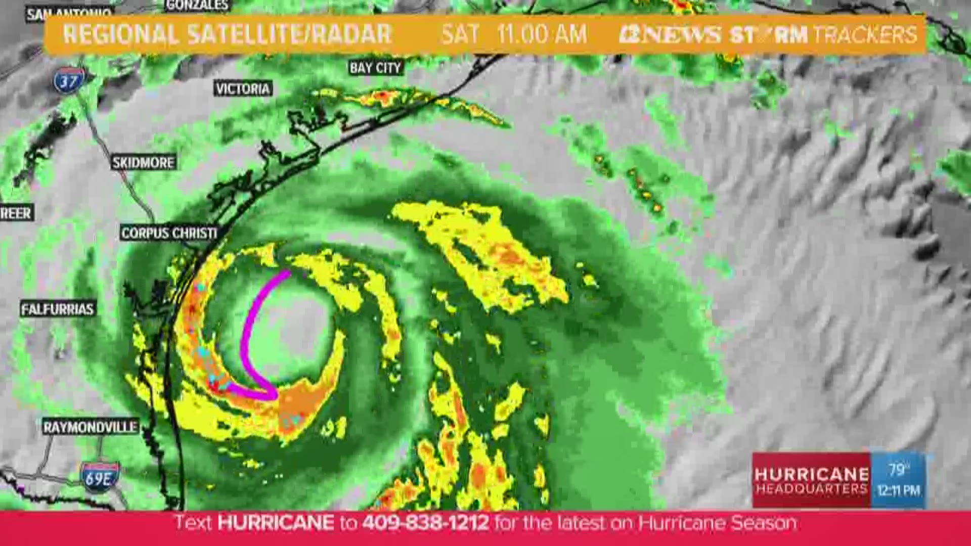
Hurricane Hanna continued to intensify as it barreled toward the Texas coast for landfall Saturday, bringing the threat of dangerous flooding and powerful winds to the Corpus Christi area. The storm made landfall at 5 p.m. Saturday on South Padre Island before making a second landfall in Kenedy County.
HURRICANE WARNINGS are in effect for Port Mansfield to Mesquite Bay, Texas.
A STORM SURGE WARNING is in effect for Port Mansfield to Sargent Texas.
Hanna continues her westward march over Texas at 9 mph. The National Hurricane Center believes a gradual turn toward the west-southwest is expected by tonight through Sunday.
WHAT TO EXPECT
SATURDAY: The current forecast shows Hanna making landfall near Corpus Christi as a category 1 hurricane.
South Texas is bracing for dangerous storm surge with Port Mansfield forecast for peak surge of 2-4 feet. Baffin Bay to Sargent, Texas, including Corpus Christi Bay, could see peak surge of 3-5 feet as Hanna makes landfall.
Hurricane conditions are expected in the warning area this afternoon.
Hanna is expected to produce 6 to 12 inches of rain with isolated maximum totals of 18 inches through Sunday night in south Texas.
Southeast Texas and the Louisiana coast could see 3-5 inches of rain.
SUNDAY: As Hanna moves inward to the Mexican states of Coahuila and Tamulipas, tropical moisture will continue to be filtered in from the Gulf. Southeast Texas could see heavy tropical downpours continue into Sunday afternoon before things begin to dry up.
We will also watch a tropical wave move out of Africa over the next several days. Models indicate this could be the next system to keep an eye on.
2020 HURRICANE SEASON
The Atlantic Hurricane season began on June 1, and it was an early start to what is forecast to be a busy year for the tropics.
T.S. Arthur and T.S. Berta both formed before hurricane season officially began, making 2020 the sixth hurricane season in a row with at least one named storm before June 1.
T.S. Cristobal became the earliest third name storm on record in the Atlantic Basin when it formed in the Gulf of Mexico on June 1.
RELATED: Bertha becomes post-tropical cyclone
NOAA has forecast an above-average hurricane season.
NOAA predicts there will be 13 to 19 named storms (winds of 39 mph or higher), of which six to 10 could become hurricanes (74 mph or higher). NOAA forecasts that there could be between three to six major hurricanes (Storms that reach category 3 or above).