BEAUMONT, Texas — The line of severe storms that blew through Southeast Texas late Friday night into the wee hours of Saturday morning turned out to be more of a wind event and only left up to a couple inches of rain in the northern reaches of the area.
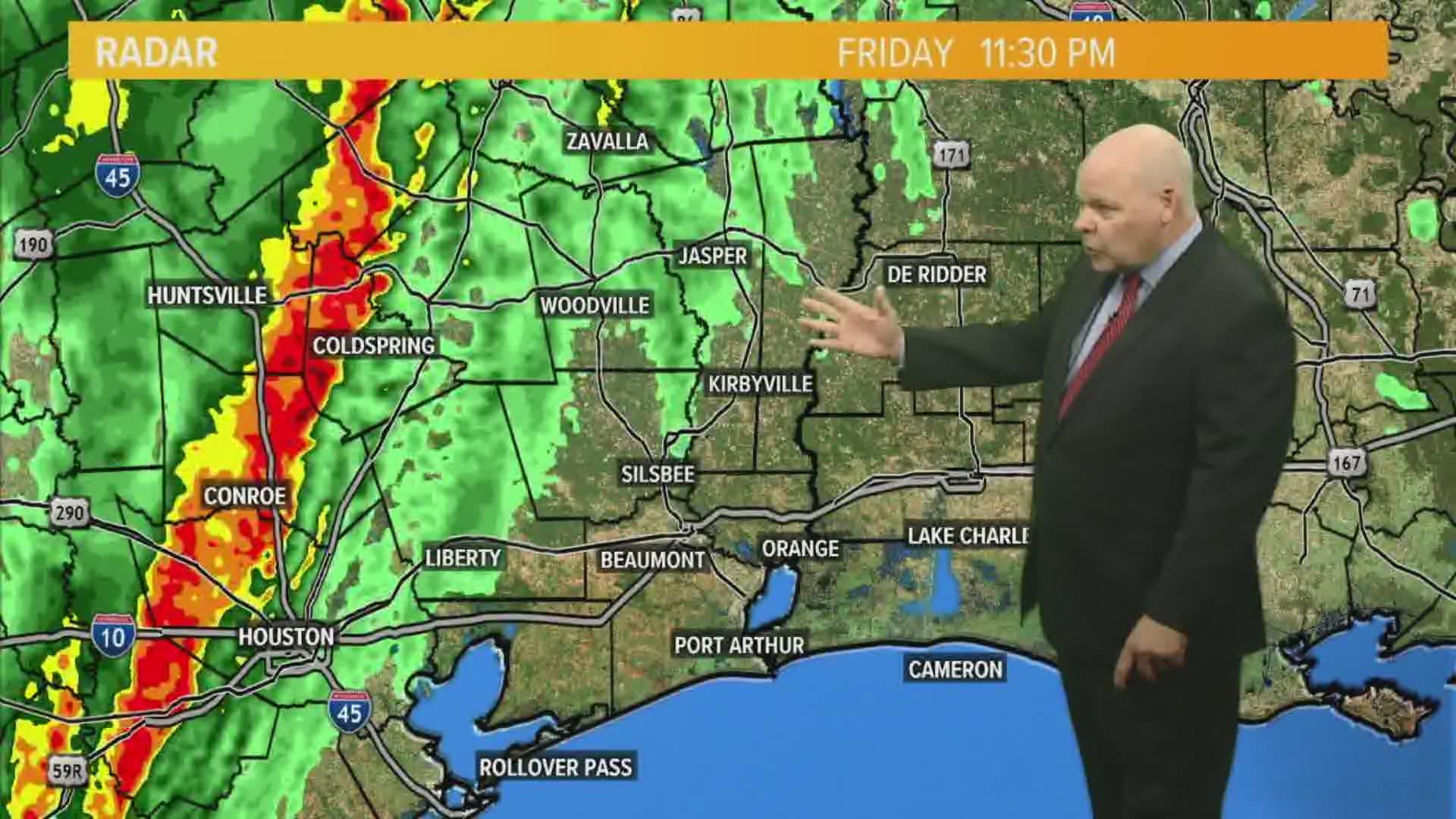
The heaviest rains didn’t hit Beaumont until 2 a.m. Saturday morning as the leading edge of the system passed by.
As predicted the worst of the storm was completely out of the area and over Lake Charles just after 4 a.m.
The bulk of the storm passed over Orange and into Louisiana by around 3:45 a.m.
GET NEWS & WEATHER ALERTS | Download the 12News App to your mobile device
The storm spawned several severe thunderstorm warnings in the region as well as several tornado watches but was mainly a wind event.

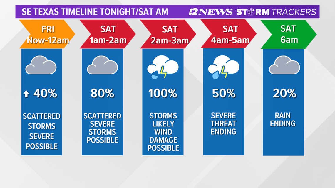
A tornado warning was issued briefly for portions of Jasper County around midnight Saturday though none were reported.
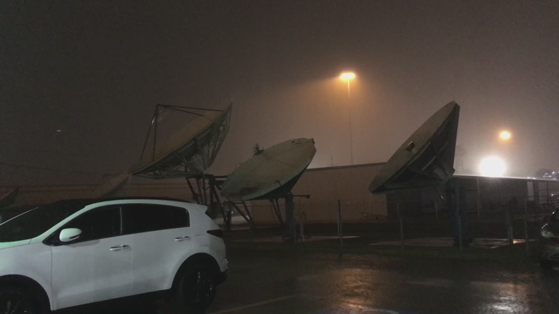
Winds gusted from 40 to nearly 70 mph as the line literally blew through the area according to meteorologist Jeff Gerber.
Officially a gust of 69 mph was recorded at Jack Brooks Regional Airport near Nederland.
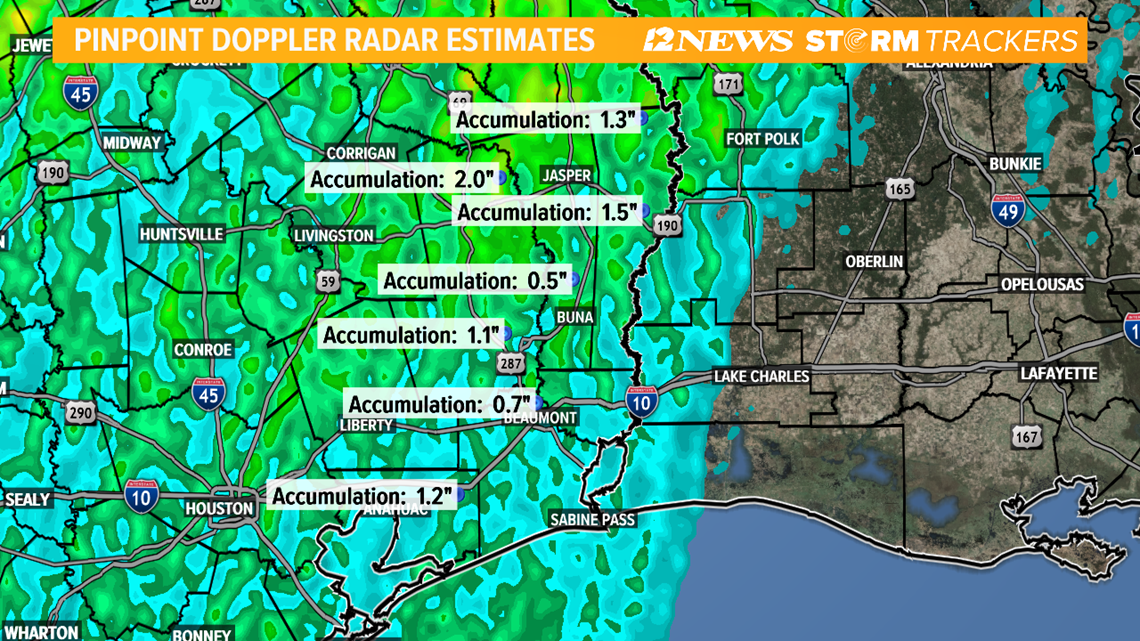
The storms dropped from about 2 inches in the northern end of Tyler County to a half inch north of Buna.

The storm had been forecast to potentially spawn isolated tornadoes, heavy rain and hail but didn’t live up to its forecast potential.
No hail or tornadoes were reported.
Late Friday night nearly 3,000 Entergy customers in Lumberton were without power for several hours until almost 1 a.m. according to Entergy’s online outage website.
Chief Meteorologist Patrick Vaughn said he expects Southeast Texas to be rain free by about 6 a.m. Saturday as the system moves over Southwest Louisiana.
The sun should come out for the day and temperatures are expected to drop Saturday possibly getting as low as the 40s by 7 p.m. Saturday.
RELATED: Power outages in Southeast Texas