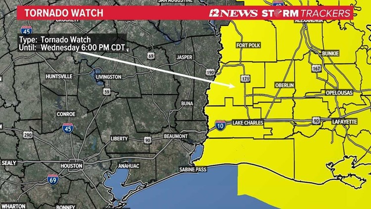
BEAUMONT, Texas — A TORNADO WATCH was issued Wednesday morning for Jefferson, Orange, Newton, Jasper, Tyler, Liberty counties until 6 p.m. But the line of strong and potentially severe storms are shifting out of Southeast Texas skies, making way for the sun.
The Storm Prediction Center predicts mostly cloudy skies early Wednesday afternoon, then sunny conditions with a steady temperature around 73 degrees.
A chance of precipitation is at 90 percent, as of Wednesday afternoon, with west wind around 10 mph and gusts as high as 20 mph.
This is part of a dangerous tornado outbreak across the Deep South.
The Storm Prediction Center has issued its highest threat level for severe weather, 'high risk' for parts of the lower-Mississippi Valley and Alabama.
The last time a high-risk severe weather warning was issued was in May 2019.
Several tornadoes have been reported across central Mississippi and Alabama. And the NWS says the situation will only deteriorate throughout the afternoon.
GET NEWS & WEATHER ALERTS | Download the 12News App to your mobile device
Timeline: Thursday-Sunday
The severe storms will clear and make way for a beautiful day across Southeast Texas.
Temps will be in the low 50s in the morning and upper 60s to low 70s in the afternoon. Cooler, drier air is expected to be in place through the weekend.
Friday, Saturday and Sunday will see chilly mornings with lows in the 40s, but temps will warm up into the low 70s.